
Bring detected drone activity, local property-use records, and incident review into one municipal workflow. SkyTrade Protect is designed for situational awareness; coverage depends on the sensors, feeds, and integrations in your deployment.
Looking for a free app to see drones near you? Read our guide to live drone radar maps and apps.
A short walkthrough of the live airspace dashboard: real-time detection, permit verification, geofenced alert zones, and incident playback in a single municipal view. Audio is muted by default, use the player controls to play, pause, and unmute.
A phone app displays compatible Remote ID broadcasts it can receive. Municipal teams also need available property-use records, context for an incident, and a response owner. A missing local permit does not establish an unlawful flight. For consumer reception limits, read our live drone radar guide.
Review observed drone activity alongside relevant site boundaries and available advisory information. Confirm the sources, update intervals, and coverage for your deployment.
Compare tracked activity with applicable property-use permissions and available operating records. Keep FAA authorizations separate from local approval, and allow for lawful flights requiring no municipal permit.
Structured workflows for alerting EMS, law enforcement, or emergency coordinators when an unverified or restricted drone is detected.
Operators using a municipal site can provide the information required for that property-use application. Public-safety and commercial teams must obtain the federal operating authorizations applicable to their flights separately.
Staff review requests for city-controlled sites against the applicable property-use rules and conditions. A local permit does not establish a flight corridor, authorize an altitude, or replace FAA approval.
Supported receivers and connected operator feeds can supply position and other observations to the dashboard. Confirm protocol compatibility and reception coverage; not every drone broadcasts or connects to an operator feed.
Use observed activity and configurable site alerts to prompt review. An unmatched municipal record may be a lawful overflight; the responsible team must assess the facts and applicable authority before taking action.
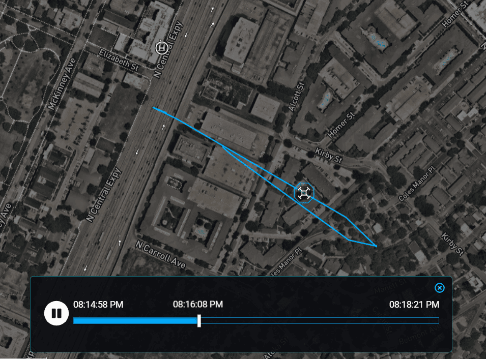
Review the observed tracks, available property-use decisions, and incident notes your deployment records. Confirm retention, access controls, export options, and any audit requirements before relying on a record for an investigation.
Use available track history and incident records to review what the system observed. Playback is limited to the data received and retained; gaps in reception cannot be reconstructed as a complete flight. Discuss timestamps, exports, and retention with the team.
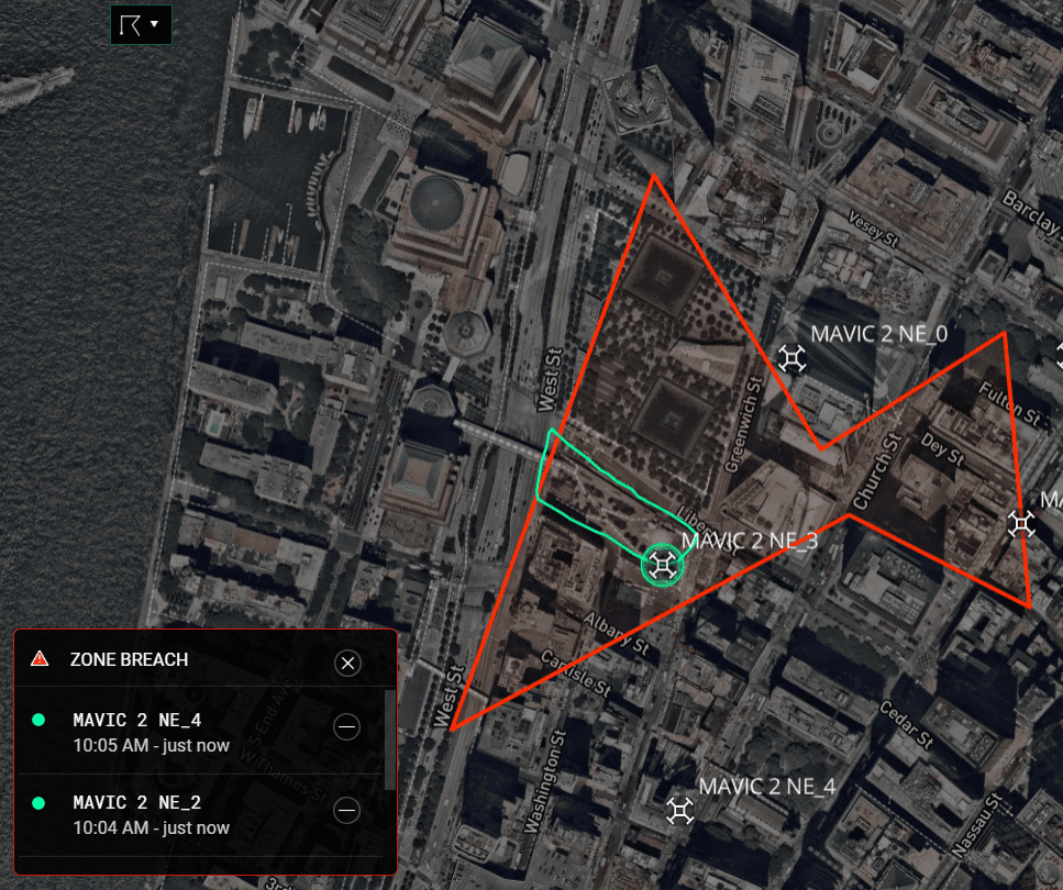
Define alert zones around the sites your team needs to monitor. Confirm supported notification channels, recipients, and sensor location estimates for the deployment. An alert zone is a review boundary, not a municipal no-fly restriction.
Select detection layers for the site, the required observations, and the response workflow. Discuss supported sensors and integrations with SkyTrade before procurement. Compare the technologies and legal considerations in our drone detection guide for cities.
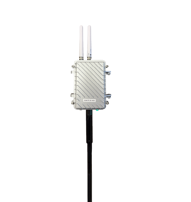
Receives compatible identification and position broadcasts within the receiver's coverage. A standard Remote ID drone reports control-station location; a broadcast module reports its takeoff point. Neither ensures all flights will be observed.
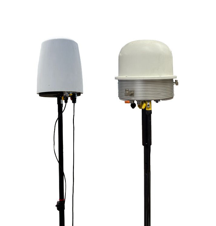
Can add observations of aircraft using supported radio links. Coverage and location estimates depend on equipment and placement. A system relying on radio emissions can miss an aircraft with no active link; communications analysis requires legal review.
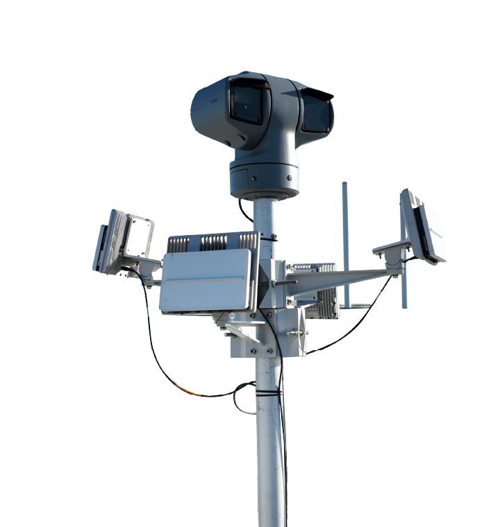
Radar can detect aircraft that emit no radio signal; visible or thermal cameras can help confirm observations. Detection, tracking, and classification have different limits. Request site-specific testing and confirm any monitoring-service arrangements.
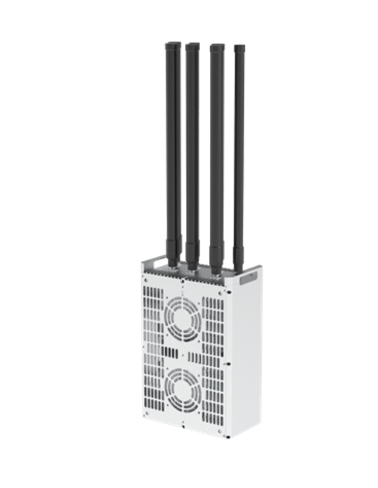
Mitigation is a separate procurement and authorization question. Eligible agencies must meet the applicable federal requirements before using counter-UAS authority. Ask whether any proposed equipment is approved and whether the personnel and operation are authorized; purchasing a system does not grant that authority.
SAFER SKIES permits conditional counter-UAS activity by eligible law enforcement and correctional agencies, alongside existing federal authorities. Accreditation, certification, equipment, and operational requirements apply. Ordinary city departments and private security do not gain authority by buying mitigation equipment.
City managers and county administrators who need to see what is happening in the airspace above public land, events, and critical infrastructure.
Fire, EMS, and police coordinators who need to deconflict drone activity during active incidents and verify DFR program compliance.
Airport-adjacent agencies, port authorities, and major infrastructure operators that manage multiple drone vendors and need a single visibility layer.
DFR program managers reviewing available mission records, policy requirements, and reporting needs with city leadership and community oversight boards.
Protect supports detection and situational awareness. SkyTrade Aerial Security is the separate patrol and live-verification offering; discuss deployment needs and operating authorizations before adding aerial response.
Explore Aerial SecuritySchedule a walkthrough with the SkyTrade team and see the live airspace dashboard configured for a real jurisdiction.
Request a DemoNo commitment required. We work with municipalities, counties, and state agencies across the US.
Answers for procurement, legal, and operations.
Municipal drone monitoring combines observations from supported sensors with incident workflows and relevant property-use records. Coverage depends on equipment, placement, and available feeds. It is different from a phone app receiving nearby Remote ID broadcasts.
SkyTrade Protect is designed for detection and situational awareness alongside municipal records. Confirm supported sensors, integrations, alerts, and retention for the deployment. An unmatched local record does not establish an unlawful flight, and no deployment should be assumed to observe every drone.
Cities can evaluate rules for public-property use and local conduct, subject to state authority and federal preemption. A municipal property-use permit does not grant federal flight authorization. Assess the facts and applicable authority before acting on a detection alert.
SkyTrade previously published SkyRadar, an Android app for nearby drone activity. Its former Google Play listing did not resolve during our October 6, 2026 review; that does not establish maintenance status or whether an existing installation works. For consumer reception limits and options, read our guide to live drone radar apps.